
Casper Aquifer Protection Plan
Originally, the Casper Aquifer Protection Plan (CAPP) was just that – a single plan. The first CAPP was generated by city and county staff, aided by numerous volunteer hours from the city-county Environmental Advisory Committee, a Technical Advisory Subcommittee of local geologists, landowners, lawyers, and other interested members of the public.
The original authors envisioned updating the CAPP every four years, but this vision has fallen prey to limited funding and other priorities. A comprehensive update begun jointly in 2007 ended up with the creation of two CAPPs: one for the City of Laramie developed by a professional consulting firm, and one for Albany County, developed by the Albany County Planning & Zoning Commission.
The 2023 update of the Casper Aquifer Protection Plan reunites the City and County plans, and offers new recommendations for the Laramie City Council and Albany County Commissioners to consider as they revise their city ordinances and county resolution, respectively, in accordance with the updated plan.

Groundwater flow of water through the Casper Aquifer
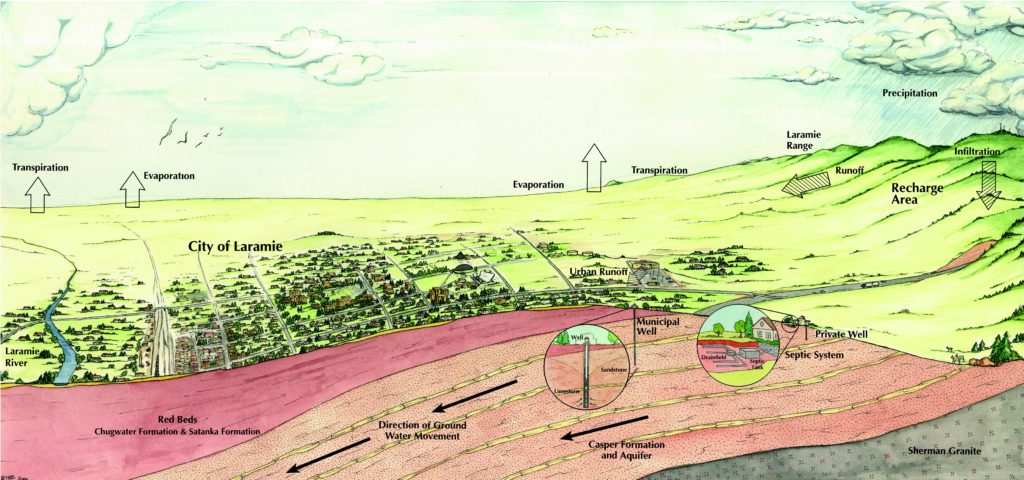
Locally, the Casper Aquifer is recharged in the area extending from Boulder Drive to the Laramie Range east of the city.
Learn more about groundwater contamination.
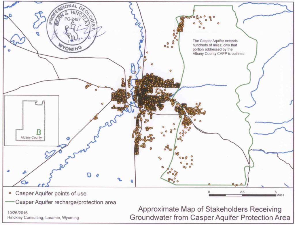
Approximate map of stakeholders receiving groundwater from Casper Aquifer Protection area.
Learn more about the Casper Aquifer Protection Plan.